On September 4, 2026, the United Nations General Assembly adopted draft A/80/L.104, later issued as A/RES/80/307, titled Correct the map: rebalancing global cartographic representation and promoting equitable representation of the world's regions, particularly Africa. The vote was 164 in favor, one against, and six abstentions.
Some coverage reduced the decision to the UN replacing or banning the Mercator projection. That is not what the resolution does. It encourages wider use of maps that represent the relative size of continents accurately, including Equal Earth and other equal-area projections, when area comparison matters. It also recognizes that different projections remain appropriate for different purposes.
What the UN Actually Decided
The resolution focuses mainly on education, geographic literacy, and the way general-purpose world maps influence perceptions of continental size. Togo introduced it on behalf of the African Group.
The text does not prohibit Mercator maps, require governments to use one specific projection, or change established cartographic practices for navigation. The resolution recognizes that every flat world map involves tradeoffs and that projection choice should depend on the map's purpose.
That distinction is important. The question is not whether Mercator is mathematically wrong. It is whether a conformal navigation projection is a good default when the purpose of a map is to compare the size of countries and continents.
Why Mercator Makes Some Places Look Too Large
Gerardus Mercator introduced his projection in 1569. Its defining property is conformality: local angles and small shapes are preserved. Constant compass bearings, or rhumb lines, also plot as straight lines. Those properties made Mercator especially useful for navigation.
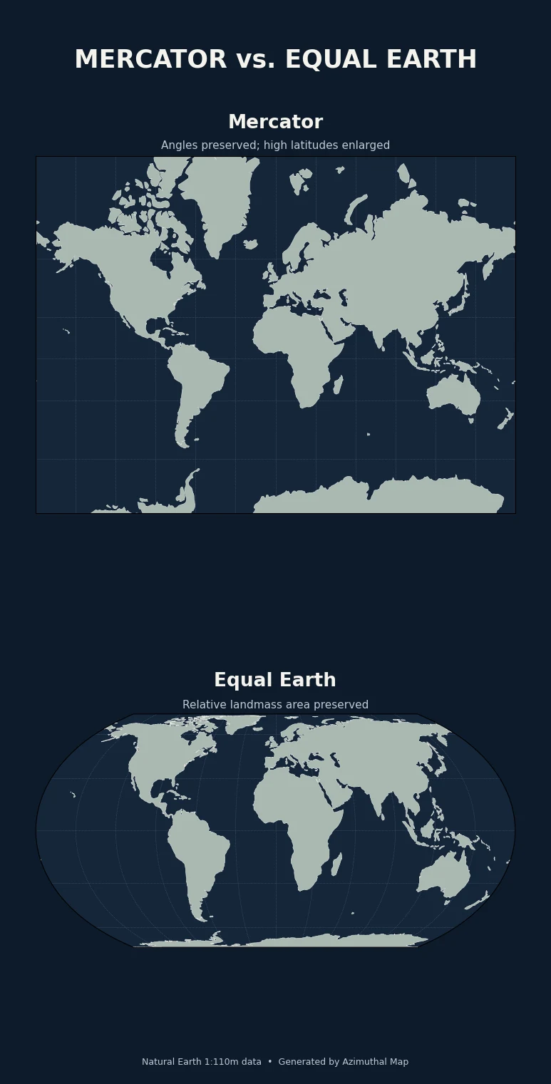
The tradeoff is area. On a spherical Mercator map, scale increases with latitude by a factor of approximately 1 / cos(latitude). Area exaggeration therefore grows rapidly toward the poles.
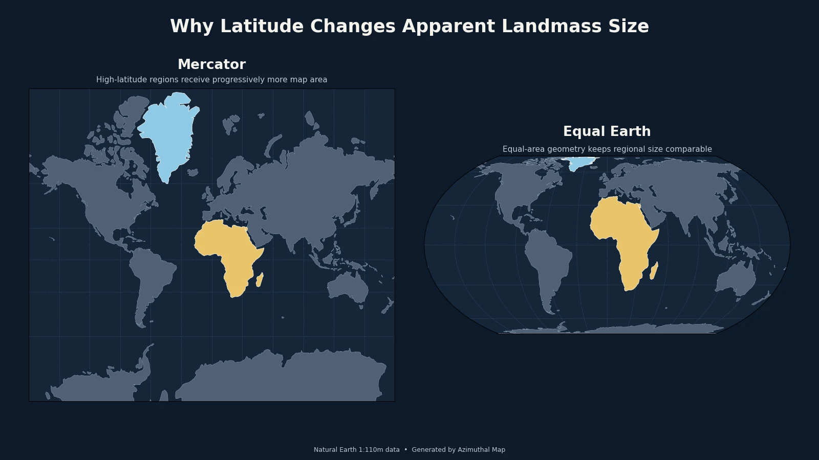
Greenland is the familiar example. Africa is roughly 14 times larger than Greenland in actual surface area, yet on many Mercator world maps the two can appear much closer in size. Northern Europe, Canada, Russia, and other high-latitude regions are enlarged for the same reason.
Mercator is therefore not an inherently inaccurate projection. It accurately preserves the property it was designed around. The problem comes from using it for tasks where relative area is the quantity readers are supposed to compare.
What Equal Earth Changes
The Equal Earth projection was introduced in 2018 by Bojan Šavrič, Tom Patterson, and Bernhard Jenny. It is a pseudocylindrical, equal-area projection designed specifically for world maps.
Equal-area means that relative surface area is preserved. If one region covers twice as much area on Earth as another, it occupies twice as much area on the map. That makes continental size comparisons fundamentally different from those on Mercator.
Equal Earth was also designed to retain a familiar, readable world-map shape. Its overall appearance was influenced by the Robinson projection, but unlike Robinson, Equal Earth preserves area mathematically.
It still distorts the globe. Shapes and angles cannot remain correct everywhere on an equal-area world map. Equal Earth simply makes a different tradeoff: it protects relative area instead of local angle.
Why Africa Is Central to the Resolution
The initiative was introduced by Togo on behalf of the African Group. Its central argument is that maps with strong latitude-dependent area distortion can affect how people perceive the relative scale of different regions, particularly when those maps are used in classrooms or as general references.
Africa is a clear case because most of the continent lies at low and middle latitudes, while Europe, Greenland, Canada, and Russia extend much farther north. A Mercator map enlarges those northern regions relative to Africa.
The resolution was adopted overwhelmingly, but the vote also included cartographic and political caveats. The United States cast the only vote against it. Six countries abstained. Ukraine, for example, objected to the way territorial boundaries were depicted in material associated with Equal Earth, while also supporting the general principle of accurate and scientifically sound cartography.
Several delegations also stressed that the resolution does not determine sovereignty, legal boundaries, or the correct projection for every mapping task.
Equal Earth vs. Lambert Azimuthal Equal-Area
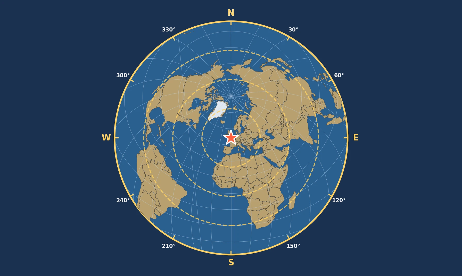
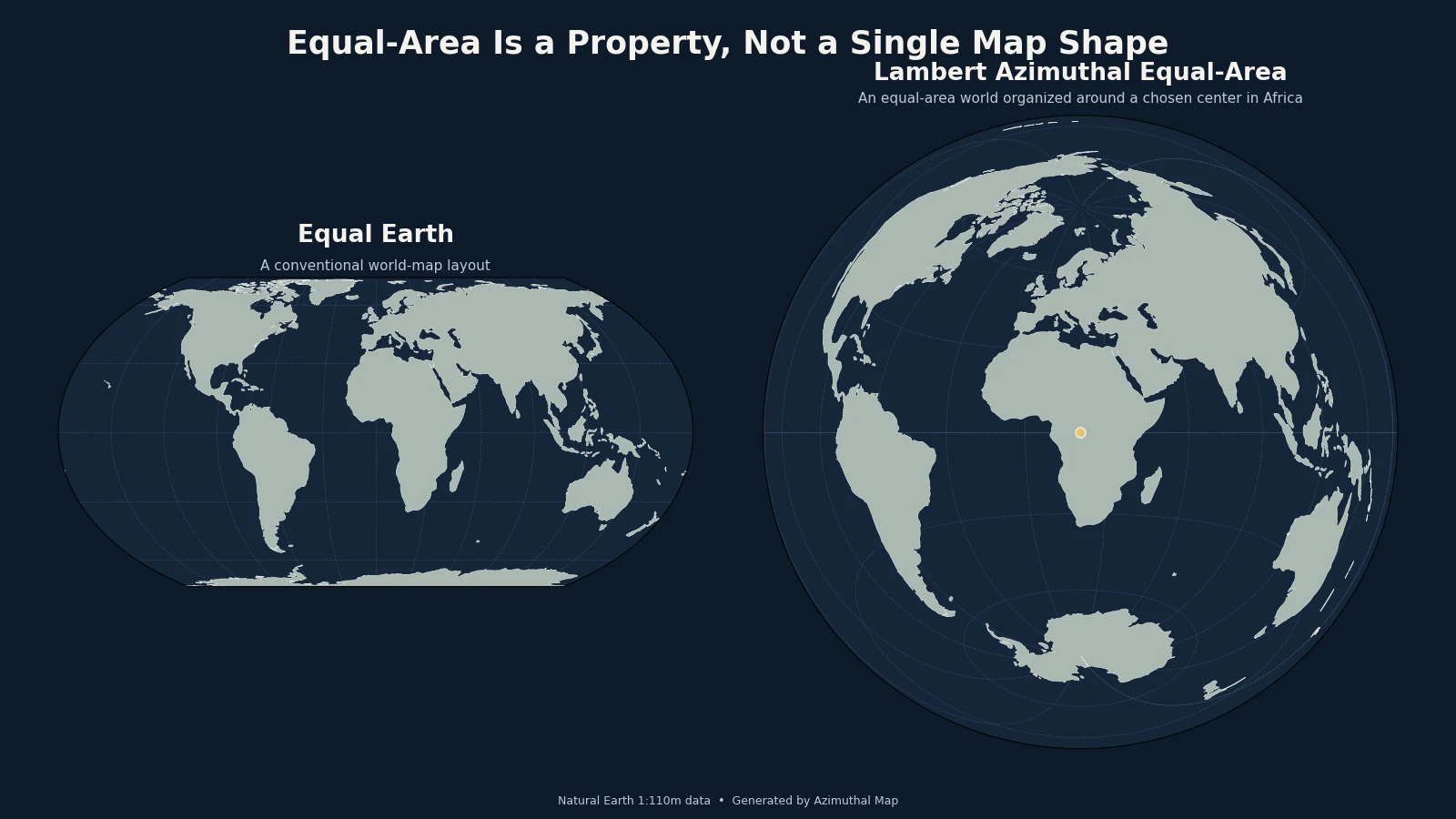
Equal Earth is not the only equal-area projection. The Lambert azimuthal equal-area projection available in the Azimuthal Map generator also keeps relative area correct, but it is designed around a chosen center point rather than a conventional rectangular world-map layout.
| Projection | Main property preserved | Best suited for |
|---|---|---|
| Mercator | Local angles and shapes | Navigation and maps where conformality matters |
| Equal Earth | Relative area | General-purpose world maps and continental-size comparison |
| Lambert azimuthal equal-area | Relative area; direction from the center | Centered thematic, continental, and hemispheric maps |
This is why "equal area" should be understood as a projection property, not the name of one specific map design. Equal Earth and Lambert azimuthal equal-area both preserve area, but their geometry and intended uses are different.
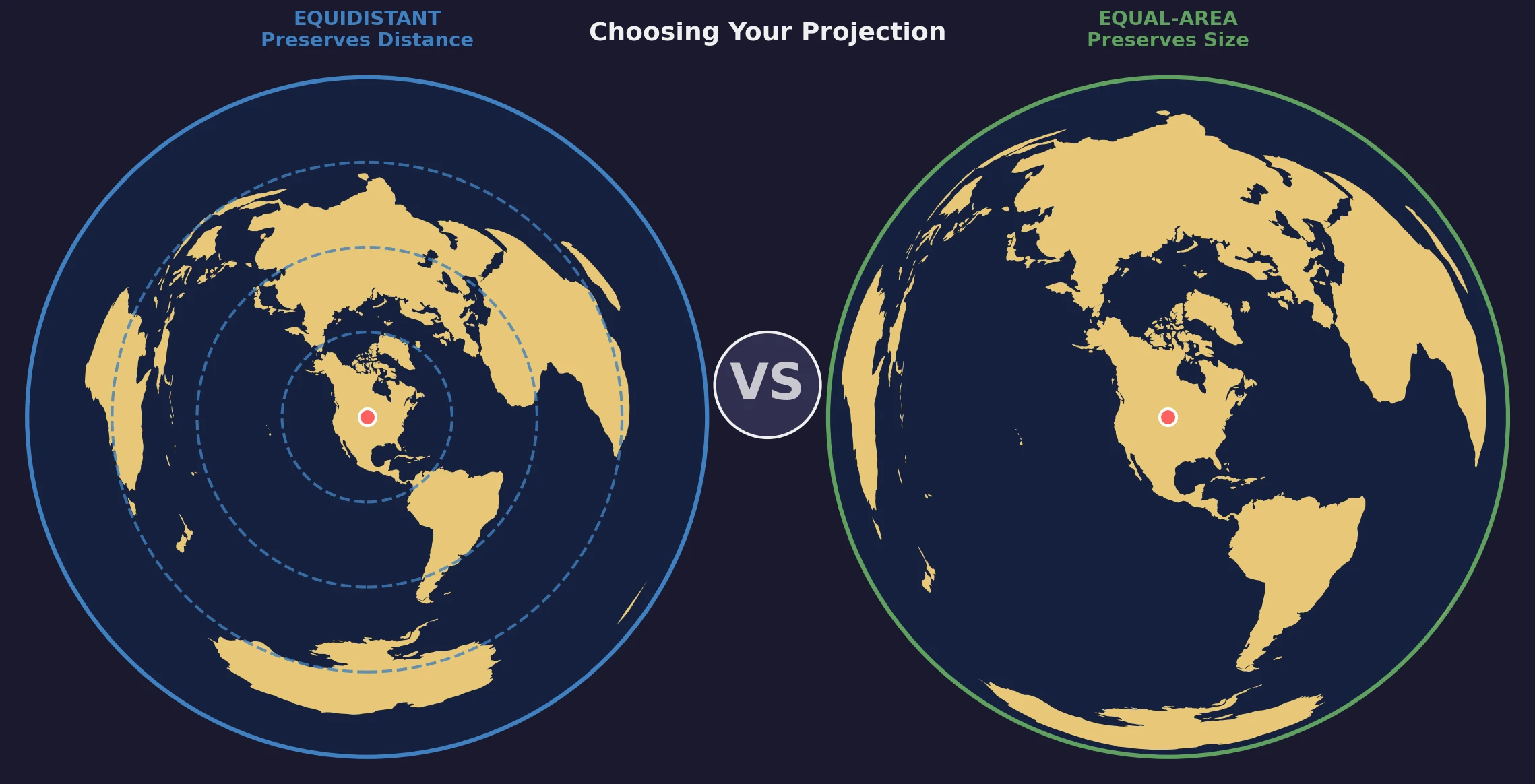
For a conventional world map where the reader should compare continents, Equal Earth is a natural choice. For a map centered on Africa, the Arctic, a city, or another specific location while still preserving area, Lambert azimuthal equal-area can be more useful. See the site's projection guide and equal-distance vs. equal-area comparison for the underlying tradeoffs.
Mercator Still Has a Purpose
The useful lesson from the UN resolution is not that one projection has become universally correct.
Mercator remains useful when conformality or straight rhumb lines matter. Equal Earth is better when a world map should preserve relative area. An azimuthal equidistant projection is more appropriate when distance and direction from a particular point are the main concern.
Map projections always involve tradeoffs. The important question is which geographic property the reader needs to trust.