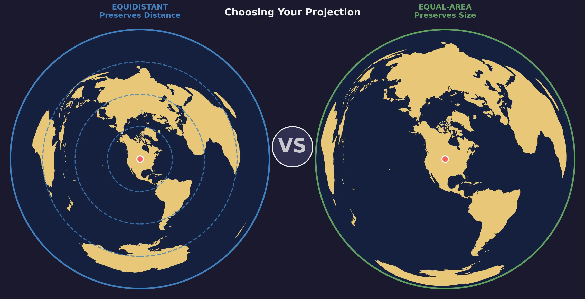
Azimuthal equidistant and Lambert azimuthal equal-area maps can look similar because both are organized around a chosen center. They are not interchangeable. One preserves distance from the center; the other preserves area.
The right choice depends on what the reader needs to measure or compare.
Quick Comparison
| Property | Azimuthal Equidistant | Lambert Azimuthal Equal-Area |
|---|---|---|
| Preserves | Distance from the center | Relative area everywhere |
| Direction from center | Correct | Correct |
| Main distortion | Area and shape away from center | Shape, angle, and distance away from center |
| Best for | Range, bearings, center-based distance | Thematic maps and area comparison |
| Antipode | Maps to the outer boundary; transverse scale becomes unbounded | Maps to the outer boundary; radial scale tends to zero and transverse scale becomes unbounded |
Azimuthal Equidistant: When Distance from One Point Matters
What It Preserves
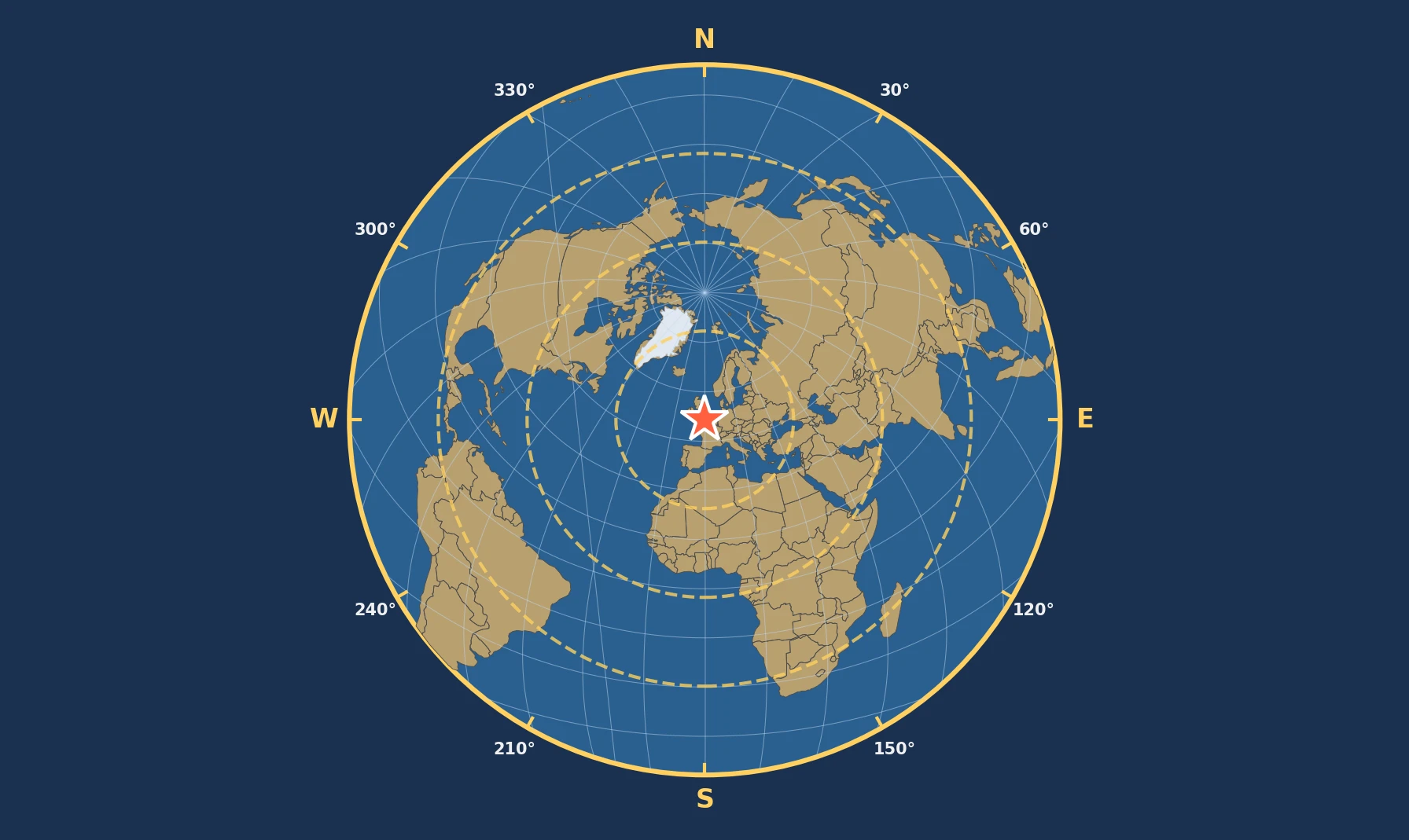
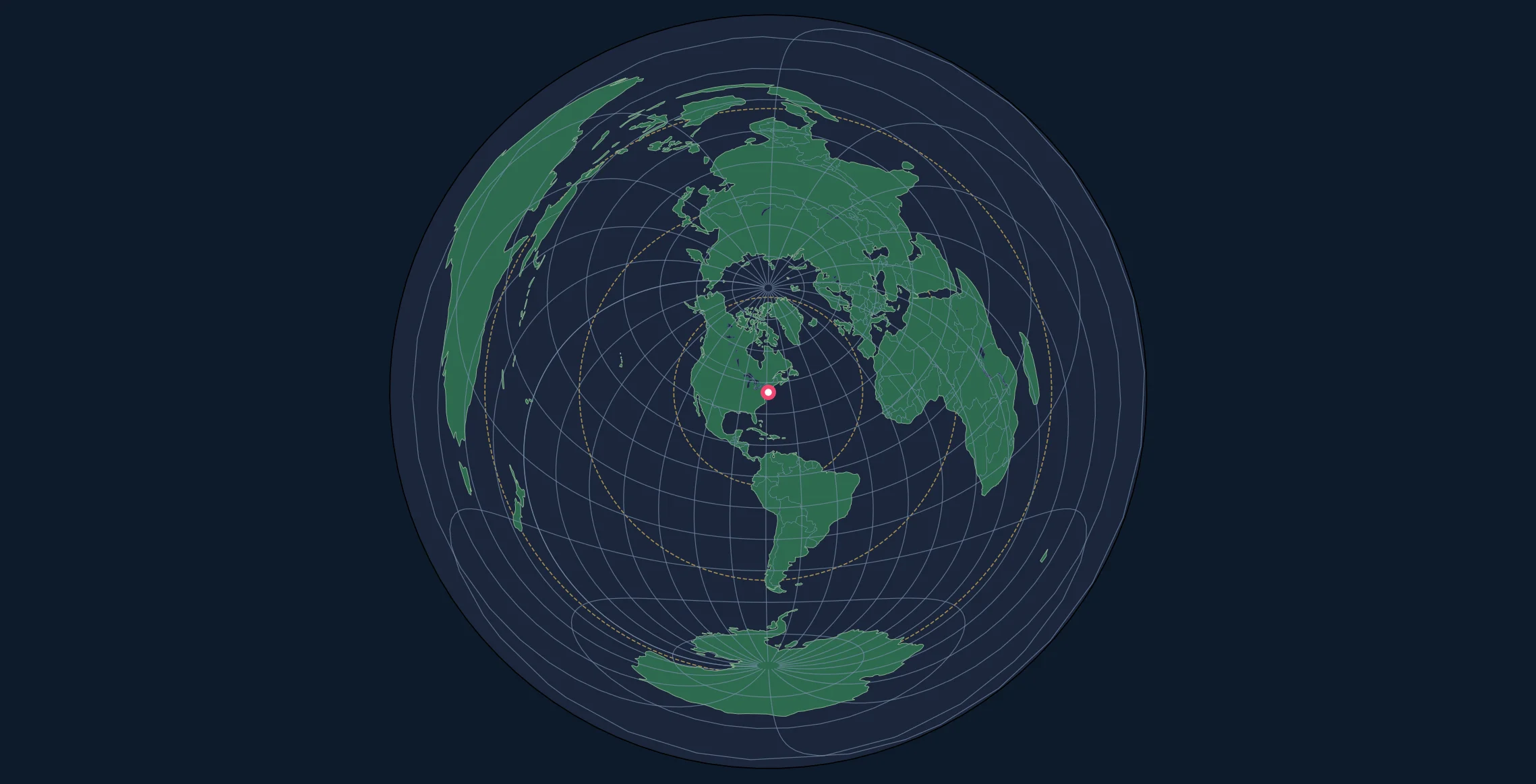
The azimuthal equidistant projection preserves true great-circle distance from the center point to every other location. If the map is centered on New York, distances from New York can be read correctly at map scale.
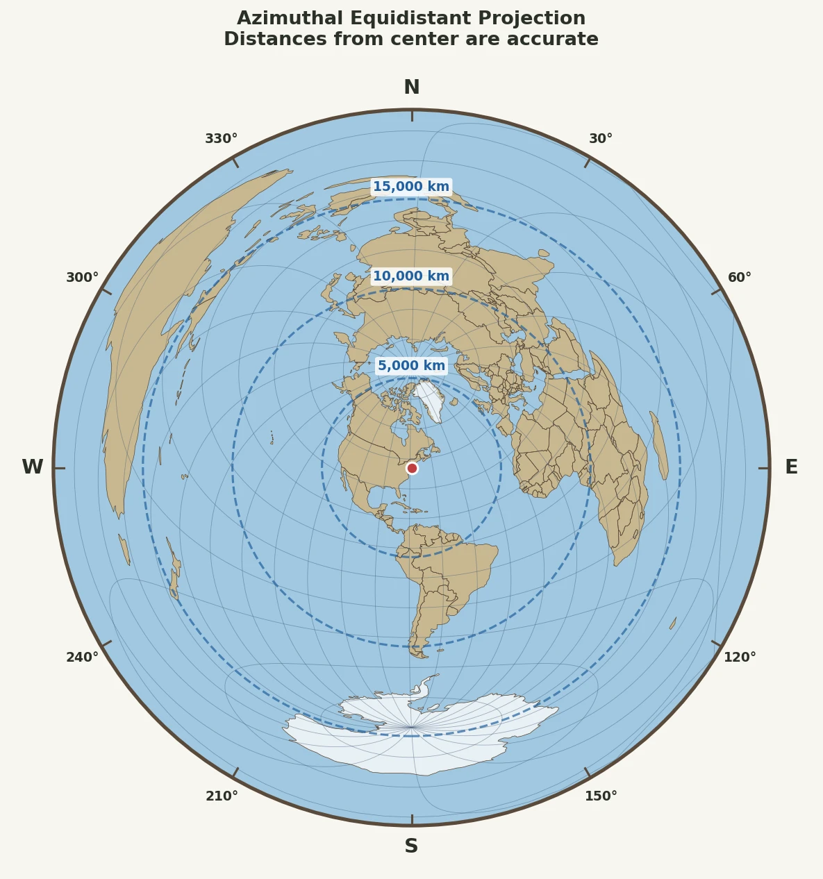
For a spherical Earth, radial map distance is:
$$\rho = R c$$
where $R$ is the sphere radius and $c$ is the angular distance from the center in radians.
That linear relationship is the projection's defining property.
What It Does Not Preserve
Distances between two points that are both away from the center are not generally correct. Area and shape distortion also increase outward.
The radial scale is 1, while the transverse scale is:
$$k_t = \frac{c}{\sin c}$$
As $c$ approaches $\pi$ at the antipode, $\sin c$ approaches zero and the transverse scale grows without bound. The single antipodal point on the globe is represented around the map's outer boundary.
Use azimuthal equidistant when you need to:
- measure distance from one location
- show range rings
- determine bearings from the center
- visualize routes radiating from one hub
- answer "how far from here?" questions
Typical examples include radio bearing maps, educational distance maps, seismology, and center-based route planning.
Lambert Azimuthal Equal-Area: When Size Must Be Comparable
What It Preserves
The Lambert azimuthal equal-area projection preserves relative area. A region that covers twice as much surface area on Earth occupies twice as much area on the map.
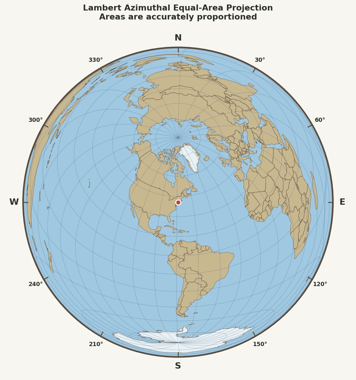
For the spherical form, radial map distance is:
$$\rho = 2R \sin\left(\frac{c}{2}\right)$$
The radial and transverse scale factors are:
$$k_r = \cos\left(\frac{c}{2}\right)$$
$$k_t = \sec\left(\frac{c}{2}\right)$$
Their product is 1, which is the equal-area condition.
What It Does Not Preserve
Distance from the center is increasingly compressed relative to great-circle distance as you move outward. Local shape and angle distortion also increase.
The antipode is still a singular case. As $c$ approaches $\pi$, radial scale approaches zero and transverse scale becomes unbounded. The antipodal point maps to the projection's outer boundary. Equal-area preservation does not mean distortion is mild there; it means local stretching in one direction is balanced by compression in the perpendicular direction so area remains correct.
Use Lambert azimuthal equal-area when you need to:
- compare the size of regions fairly
- create choropleth or thematic maps
- map density or coverage
- display environmental or statistical distributions
- produce continental or hemispheric views centered on a meaningful location
Side-by-Side Appearance
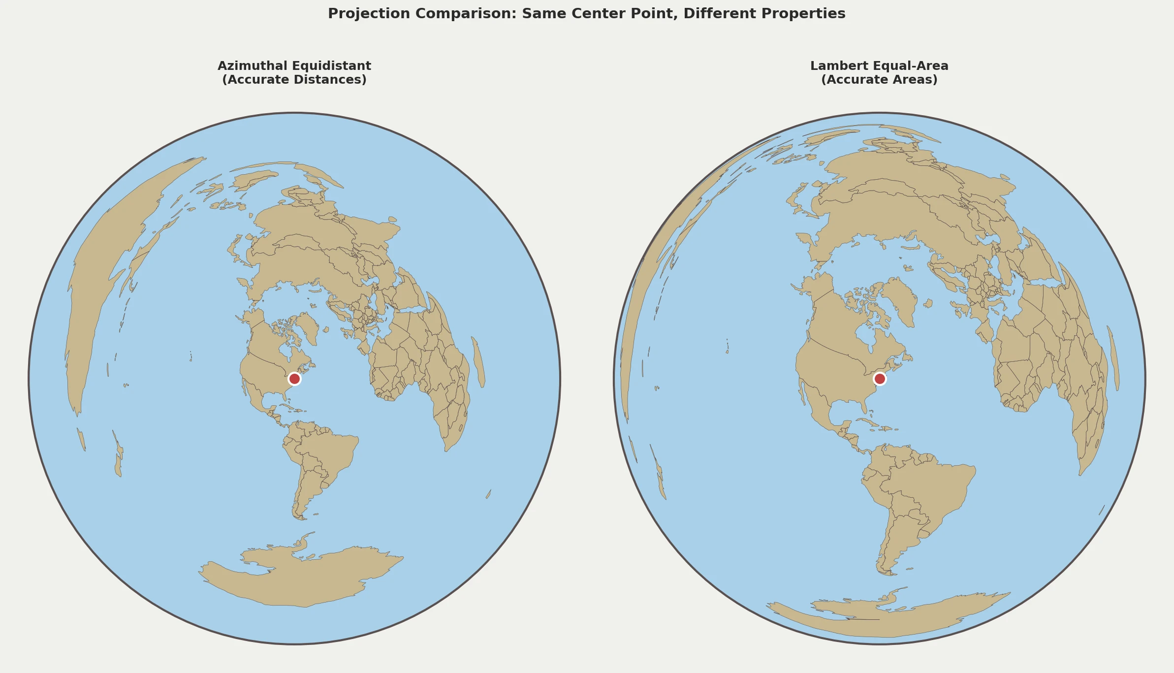
Three visual differences are especially useful:
- Outer regions: azimuthal equidistant increasingly inflates area away from the center; Lambert keeps area correct but changes shape.
- Radial spacing: equidistant radial distance is linear in angular distance; Lambert compresses radial spacing toward the outer edge.
- Local shape: neither projection should be treated as shape-preserving across the full globe.
Which Projection Should You Use?
Use azimuthal equidistant when your question starts with a center point: how far, what bearing, or what falls within a given radius.
Use Lambert azimuthal equal-area when the visual size of regions carries meaning: population, land cover, climate zones, election results, or any other thematic comparison where area should not be exaggerated.
| Application | Better choice |
|---|---|
| Distance rings from a transmitter | Azimuthal equidistant |
| Bearings from one location | Azimuthal equidistant |
| Routes from one hub | Azimuthal equidistant |
| Population or density mapping | Lambert equal-area |
| Climate or land-cover maps | Lambert equal-area |
| Comparing regional size | Lambert equal-area |
If most of the area of interest is close to the center, both projections have relatively modest distortion. If the map spans most of the globe, the tradeoff becomes much more visible.
Common Mistakes
Measuring Between Two Off-Center Points
An azimuthal equidistant map preserves distance from its center, not arbitrary pairwise distance. A New York-centered map is suitable for New York-to-Tokyo distance, but not for measuring Tokyo-to-London.
Using Equidistant for Area Comparison
An equidistant map can make regions far from the center occupy much more map area than their true relative size. That makes it a poor choice when visual area is part of the message.
Treating Equal-Area as Low-Distortion Everywhere
Equal-area means area is preserved. It does not mean shape, angle, or distance remain accurate, and it does not remove the antipodal singularity.
Ignoring the Center
Both projections are center-dependent. A polar-centered map and a Tokyo-centered map have very different distortion patterns even when they use the same projection family.
Equal Area Is a Property, Not One Map Shape
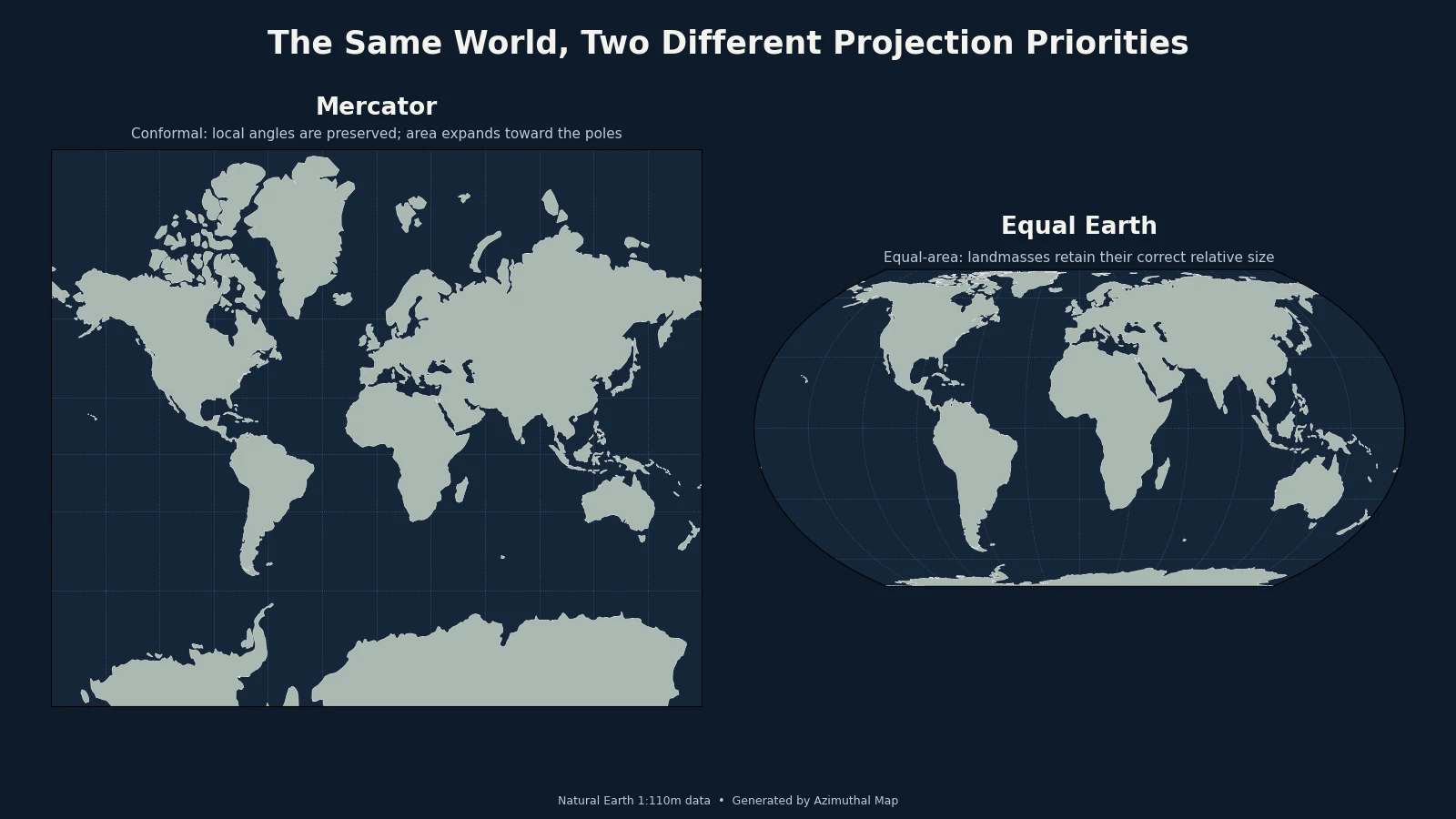
Lambert azimuthal equal-area is one of many equal-area projections. Equal Earth, for example, is designed as a general-purpose world map rather than a center-focused azimuthal map.
That distinction became especially visible in September 2026, when the UN General Assembly adopted a resolution encouraging wider use of Equal Earth and other equal-area maps where relative landmass size matters. See what the UN's Equal Earth resolution actually says for the current example.
Tissot's Indicatrices
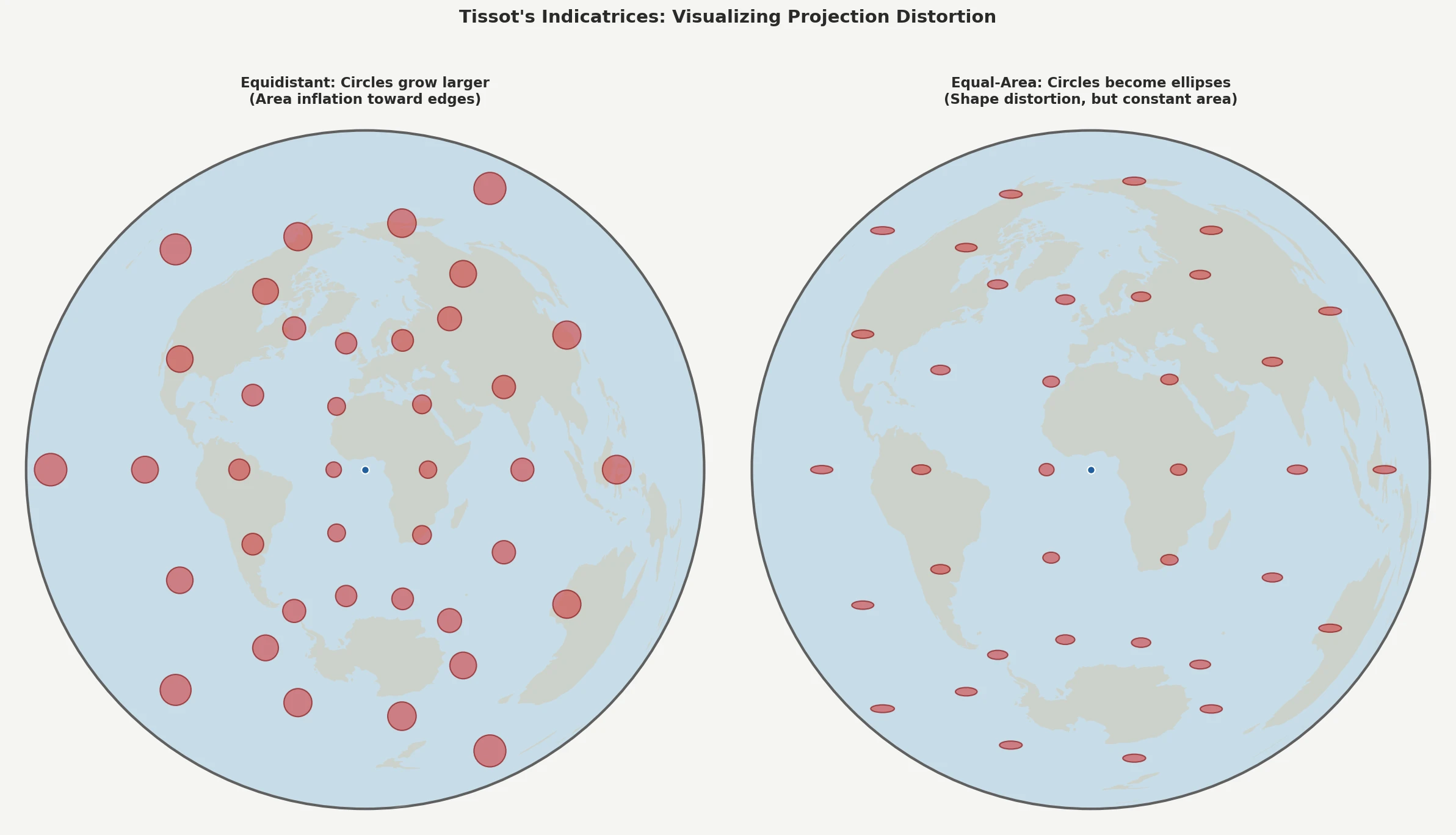
Tissot's indicatrices are a compact way to inspect local distortion. Small circles placed across an undistorted globe become circles or ellipses on the projected map:
- Azimuthal equidistant: radial scale remains correct while transverse stretching increases outward.
- Lambert azimuthal equal-area: the indicatrices become increasingly elongated, but their area stays constant.
Bottom Line
| Choose | When you need |
|---|---|
| Azimuthal Equidistant | Correct distance and direction from one center point |
| Lambert Azimuthal Equal-Area | Correct relative area across the map |
No flat projection preserves everything. Decide which property the map needs to communicate accurately, then choose the projection around that requirement.
Use the interactive map generator to switch between both projections with the same center and compare the distortion directly. For interpreting the equidistant view, see How to Read an Azimuthal Equidistant Map.